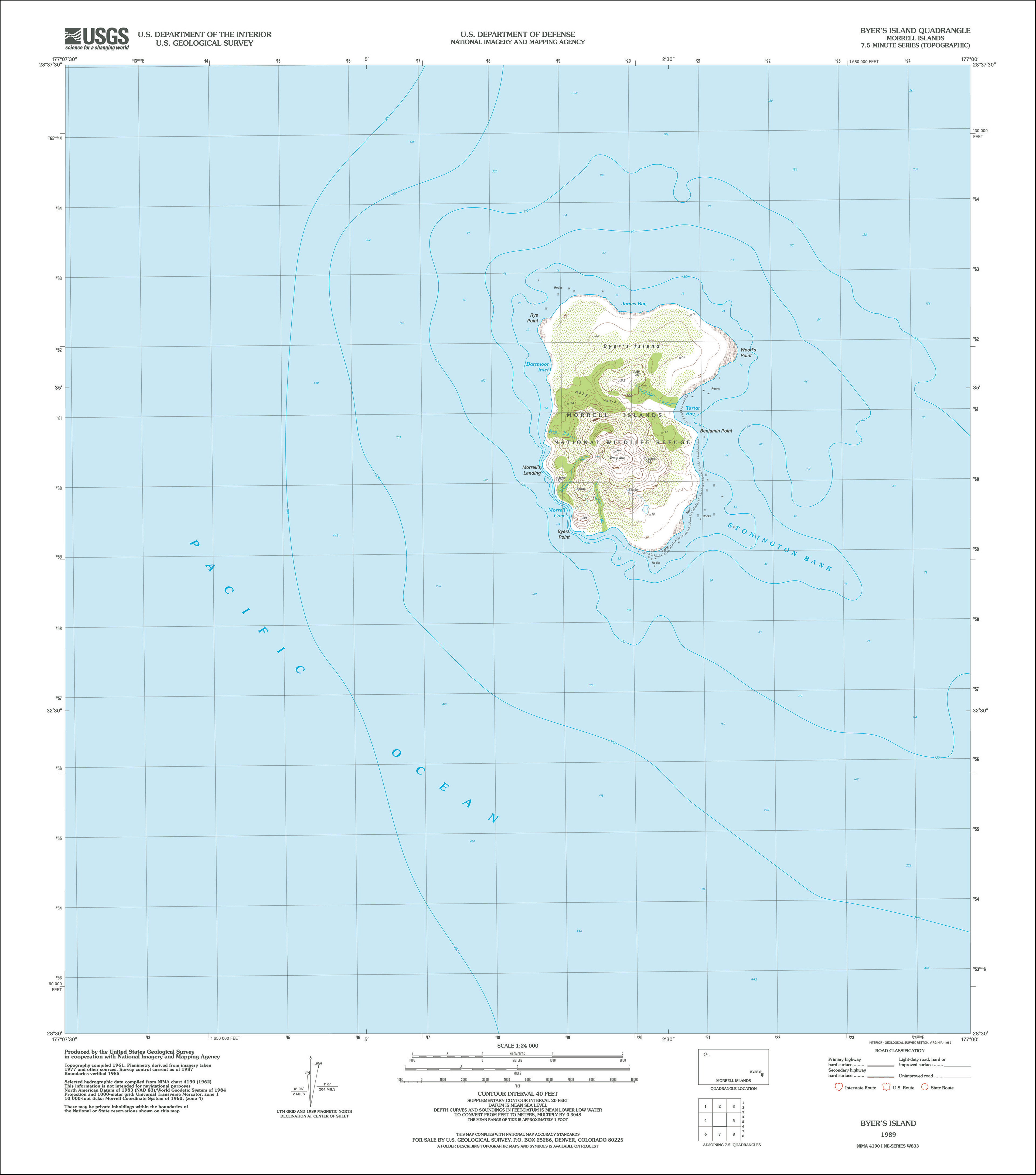
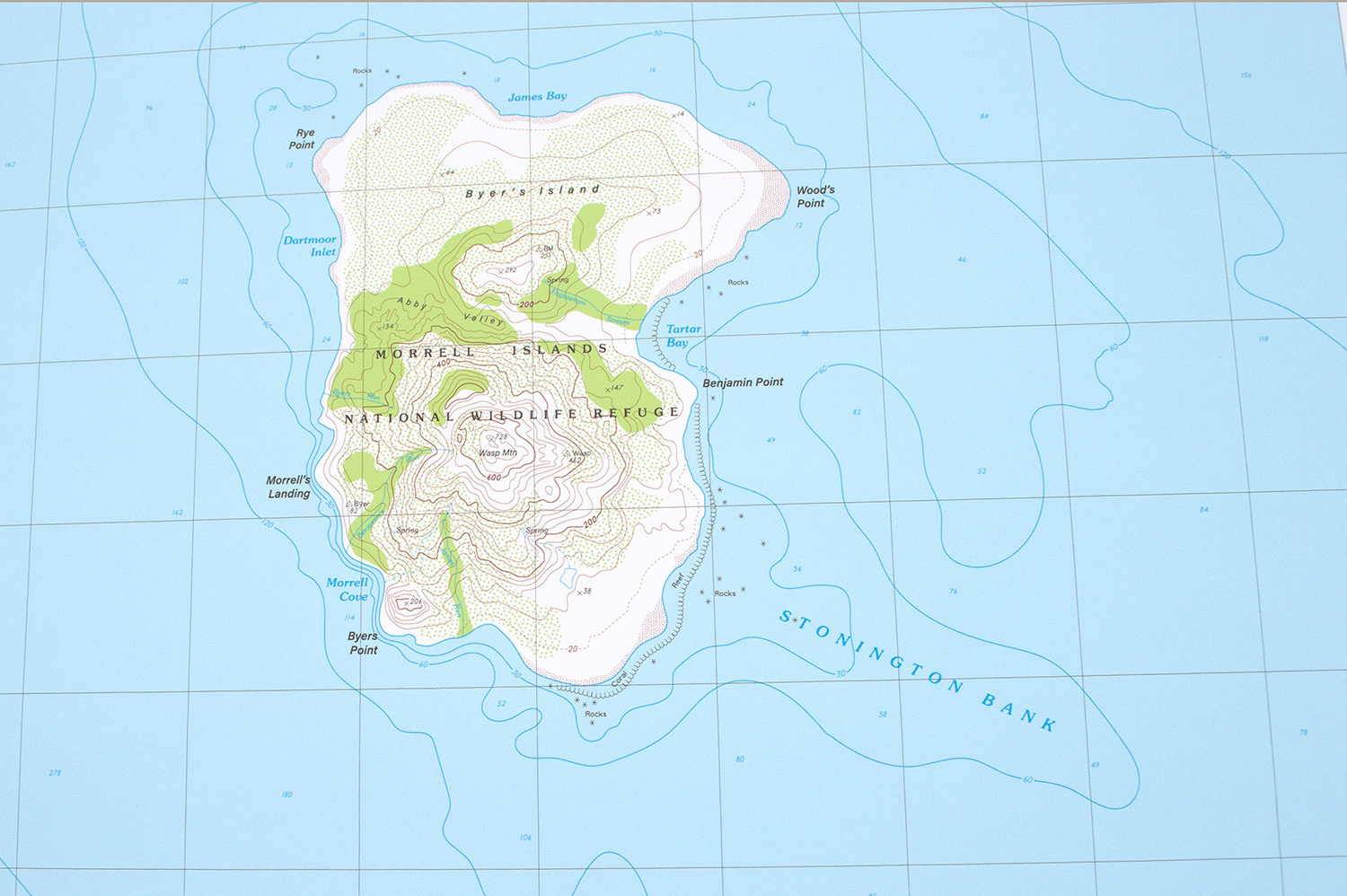
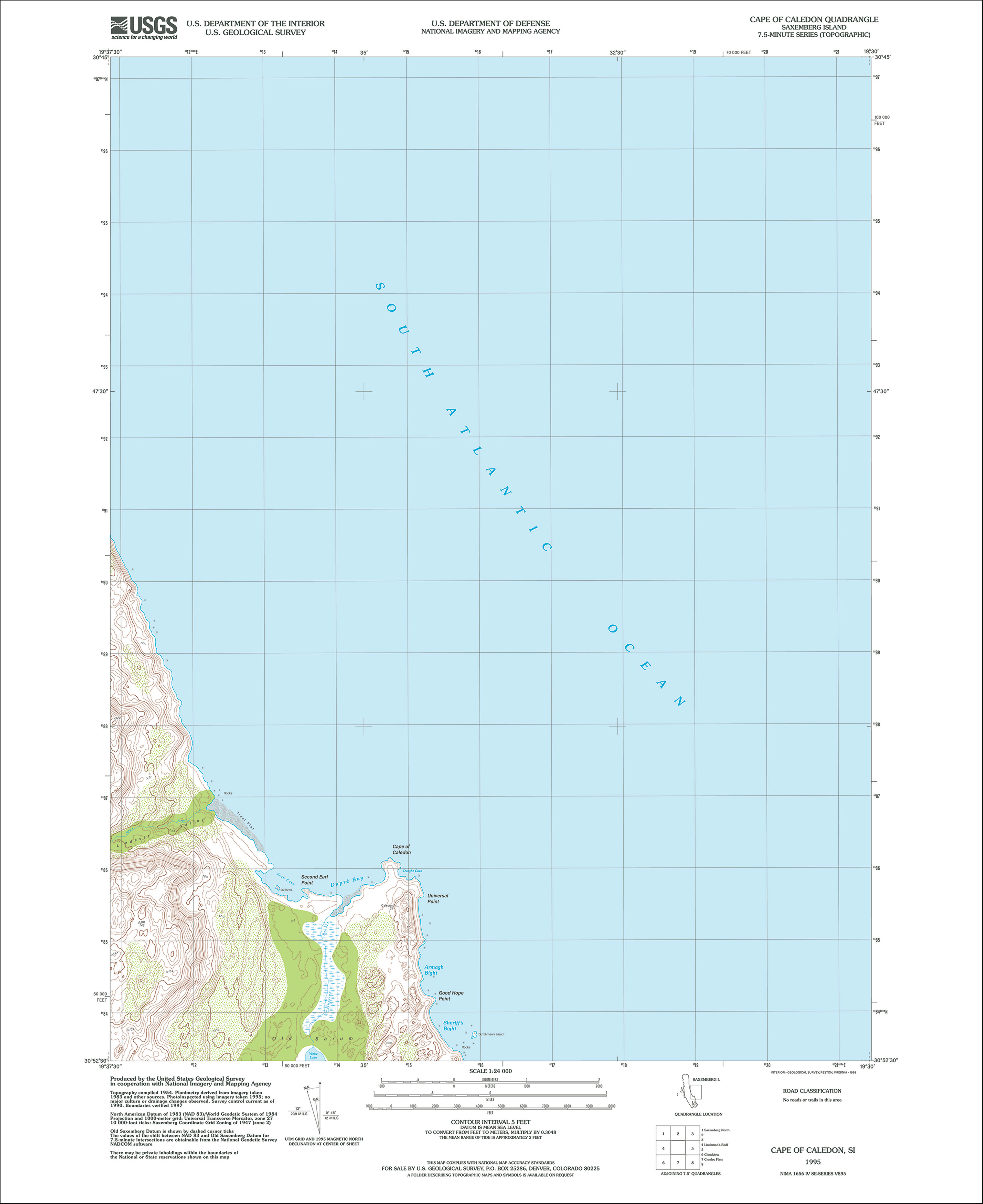
Phantom Islands | 2021-Ongoing
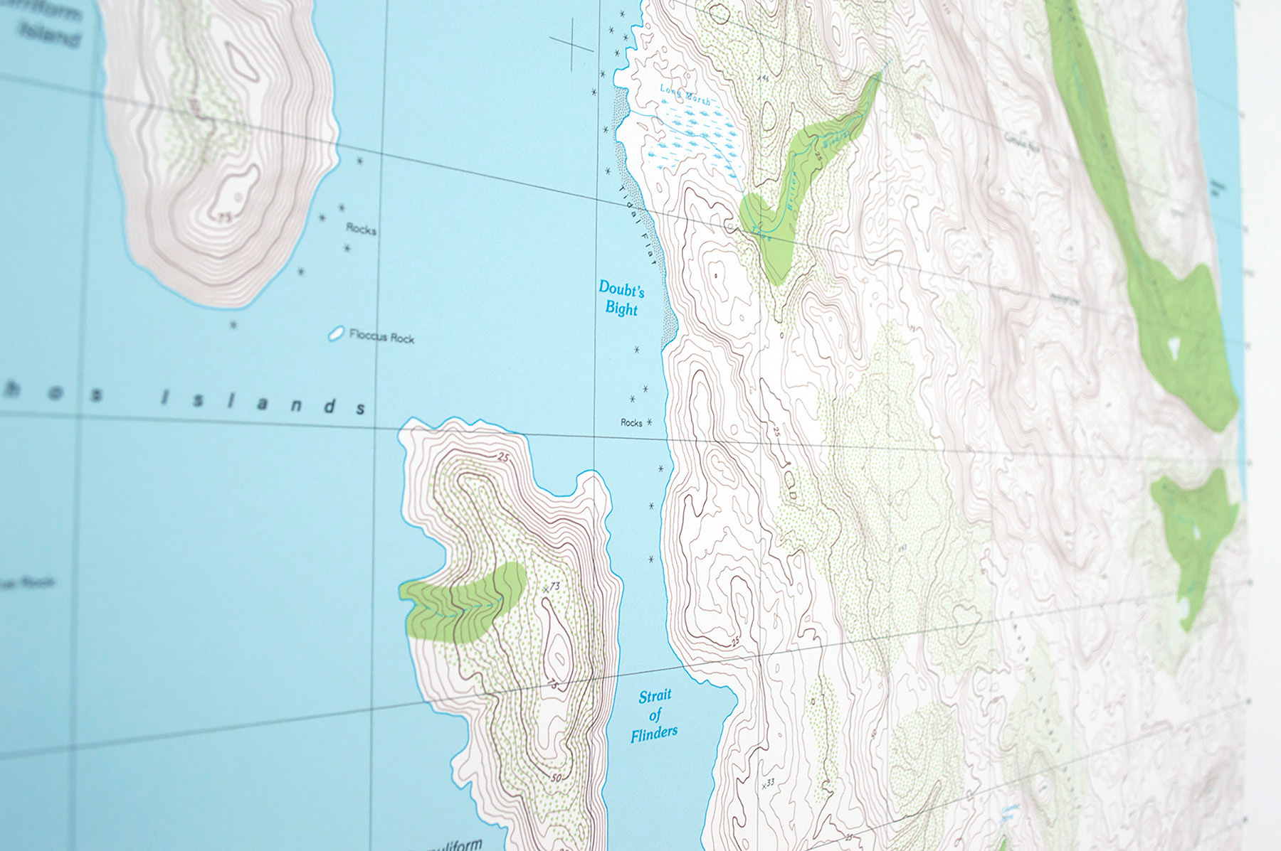
A phantom island is an island that was included on maps for a period of time, but was later found not to exist. There are numerous examples of phantom islands throughout history, ranging from the 9th to the 21st centuries. Most recently, the existence of Sandy Island (purported to have existed near New Caledonia) was disproven and removed from Google Maps in 2012.
This ongoing series of prints is created by researching explorers’ accounts of specific phantom islands, and translating this research into the language of USGS topographic 7.5-minute quadrangles. Each new map is created by pulling topography from similar land features on pre-existing quadrangles downloaded from usgs.gov, and meticulously stitching the contours of these features together with Adobe Illustrator. The stylistic elements for the specific decade of each map reproduction are also carefully replicated using design software. The global positioning and geography of each island are accurate according to historic accounts, and geographic features (if not named in the literature) are named after life events of the explorer who allegedly discovered the island, or after natural phenomena that are now believed to be what was mistaken for a landmass (such as cloud forms, icebergs, pumice rafts, or coral reefs).
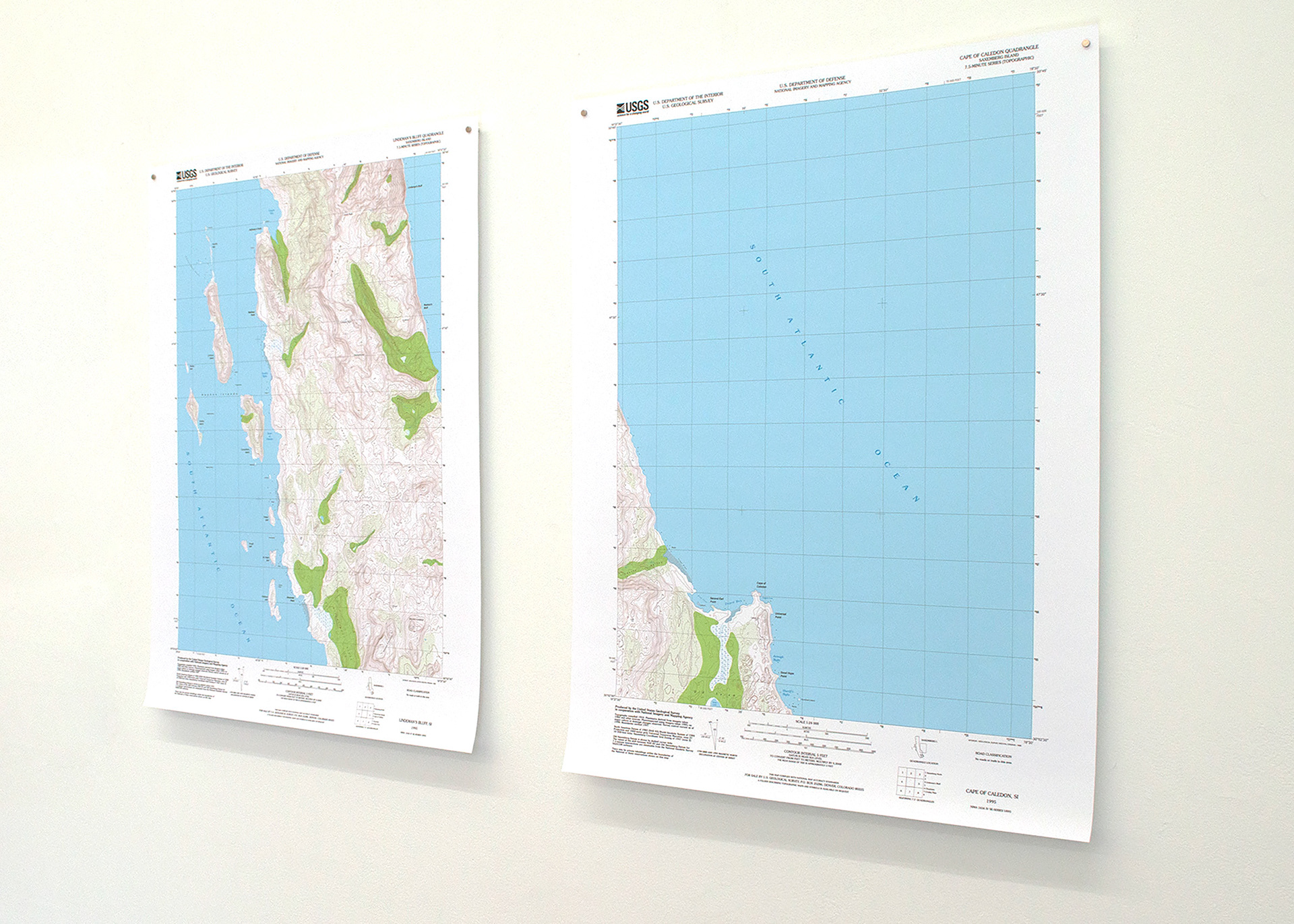
Two of six quadrangles depicting Saxemberg Island


Detail of Lindeman's Bluff Quadrangle
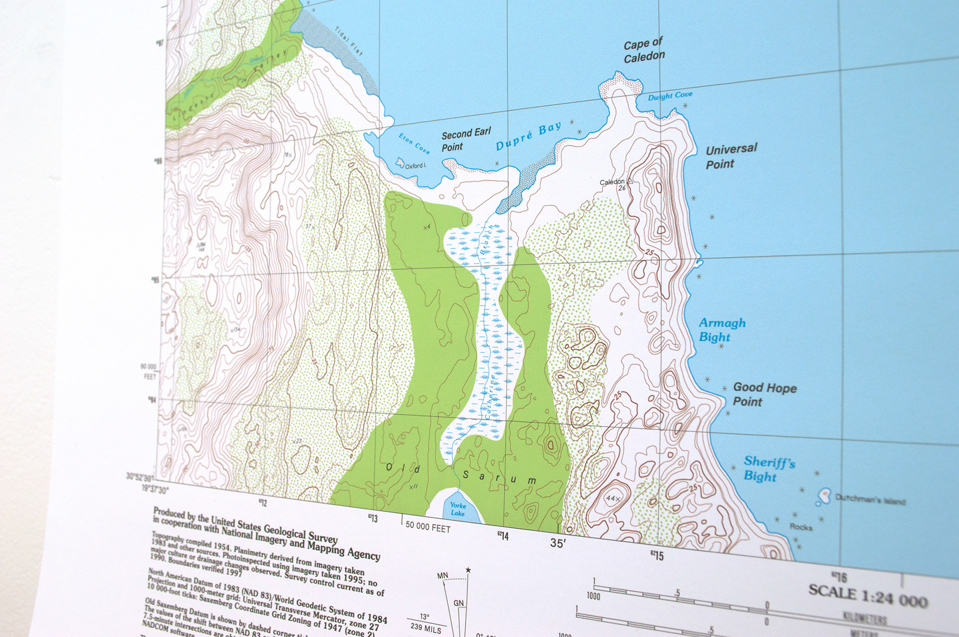
Detail of Cape of Caledon Quadrangle